Learn About The Law
Get help with your legal needs
FindLaw’s Learn About the Law features thousands of informational articles to help you understand your options. And if you’re ready to hire an attorney, find one in your area who can help.
Current as of January 02, 2025 | Updated by Findlaw Staff
Critical habitat is designated to include substrate and water in the following ten portions of the Indian River Lagoon and Biscayne Bay within the current range of Johnson's seagrass.
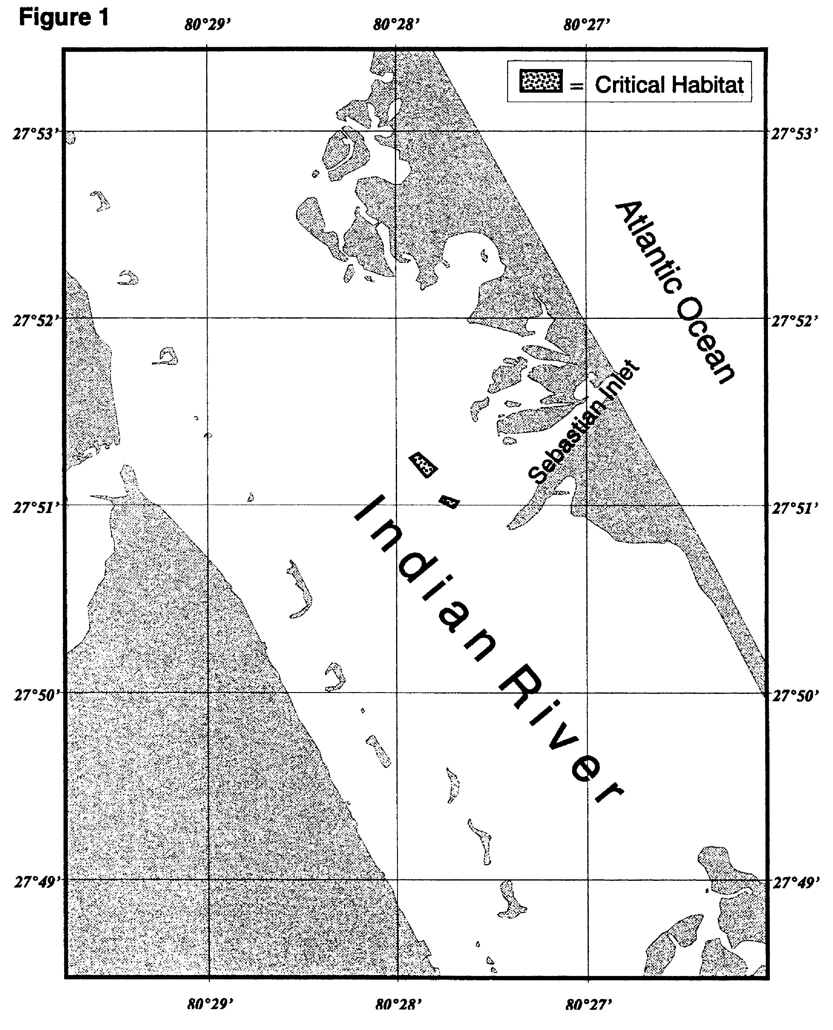
(a) A portion of the Indian River, Florida, north of Sebastian Inlet Channel, defined by the following coordinates:
Northwest corner: 27°51′15.03″N, 80°27′55.49″W
Northeast corner: 27°51′16.57″N, 80°27′53.05″W
Southwest corner: 27°51′08.85″N, 80°27′50.48″W
Southeast corner: 27°51′11.58″N, 80°27′47.35″W
(b) A portion of the Indian River, Florida, south of the Sebastian Inlet Channel, defined by the following coordinates:
Northwest corner: 27°51′01.32″N, 80°27′46.10″W
Northeast corner: 27°51′02.69″N, 80°27′45.27″W
Southwest corner: 27°50′59.08″N, 80°27′41.84″W
Southeast corner: 27°51′01.07″N, 80°27′40.50″W
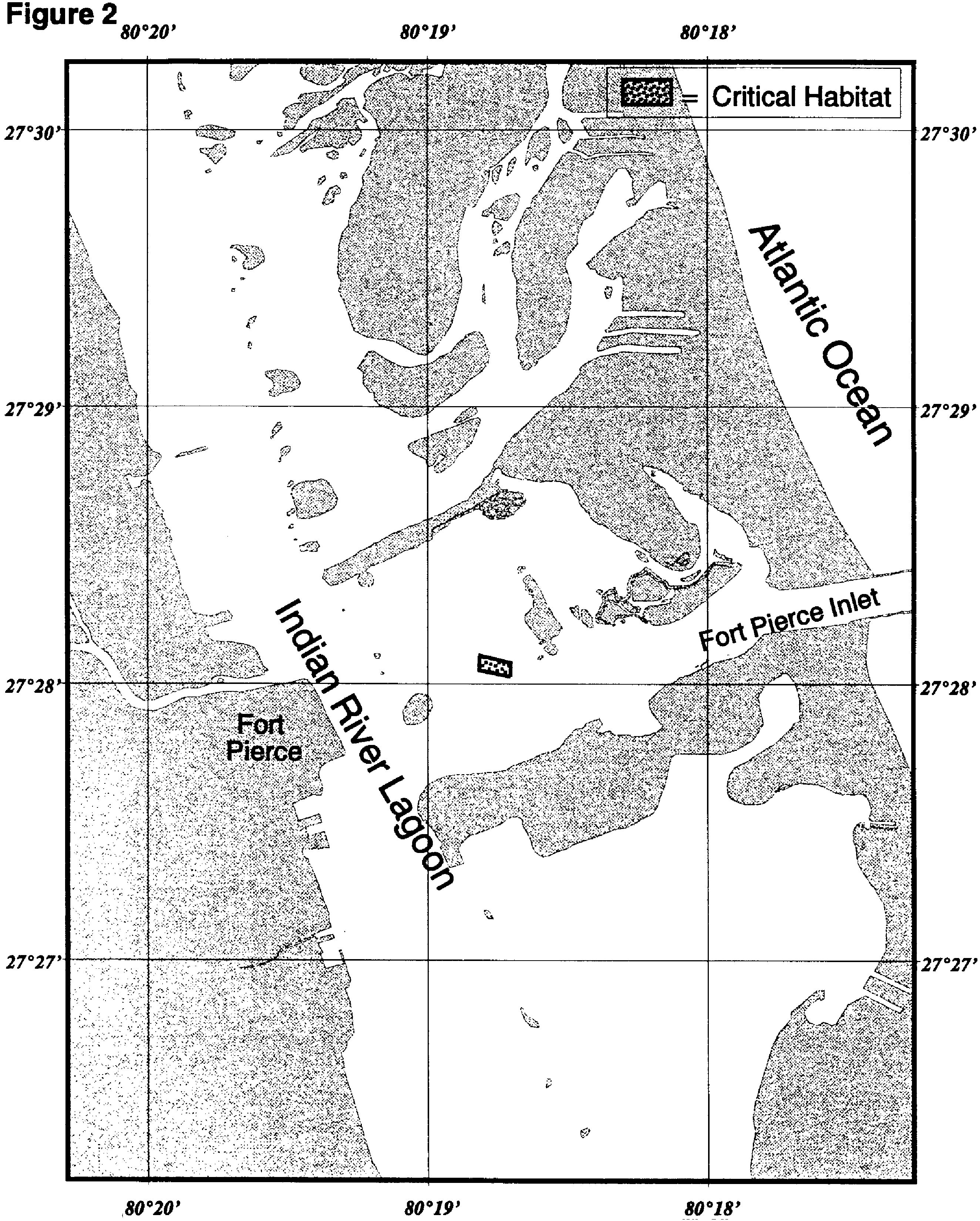
(c) A portion of the Indian River Lagoon in the vicinity of the Fort Pierce Inlet. This site is located on the north side of the entrance channel just west of a small mangrove vegetated island where the main entrance channel bifurcates to the north. The area is defined by the following coordinates:
Northwest corner: 27°28′06.00″N, 80°18′48.89″W
Northeast corner: 27°28′04.43″N, 80°18′42.25″W
Southwest corner: 27°28′02.86″N, 80°18′49.06″W
Southeast corner: 27°28′01.46″N, 80°18′42.42″W
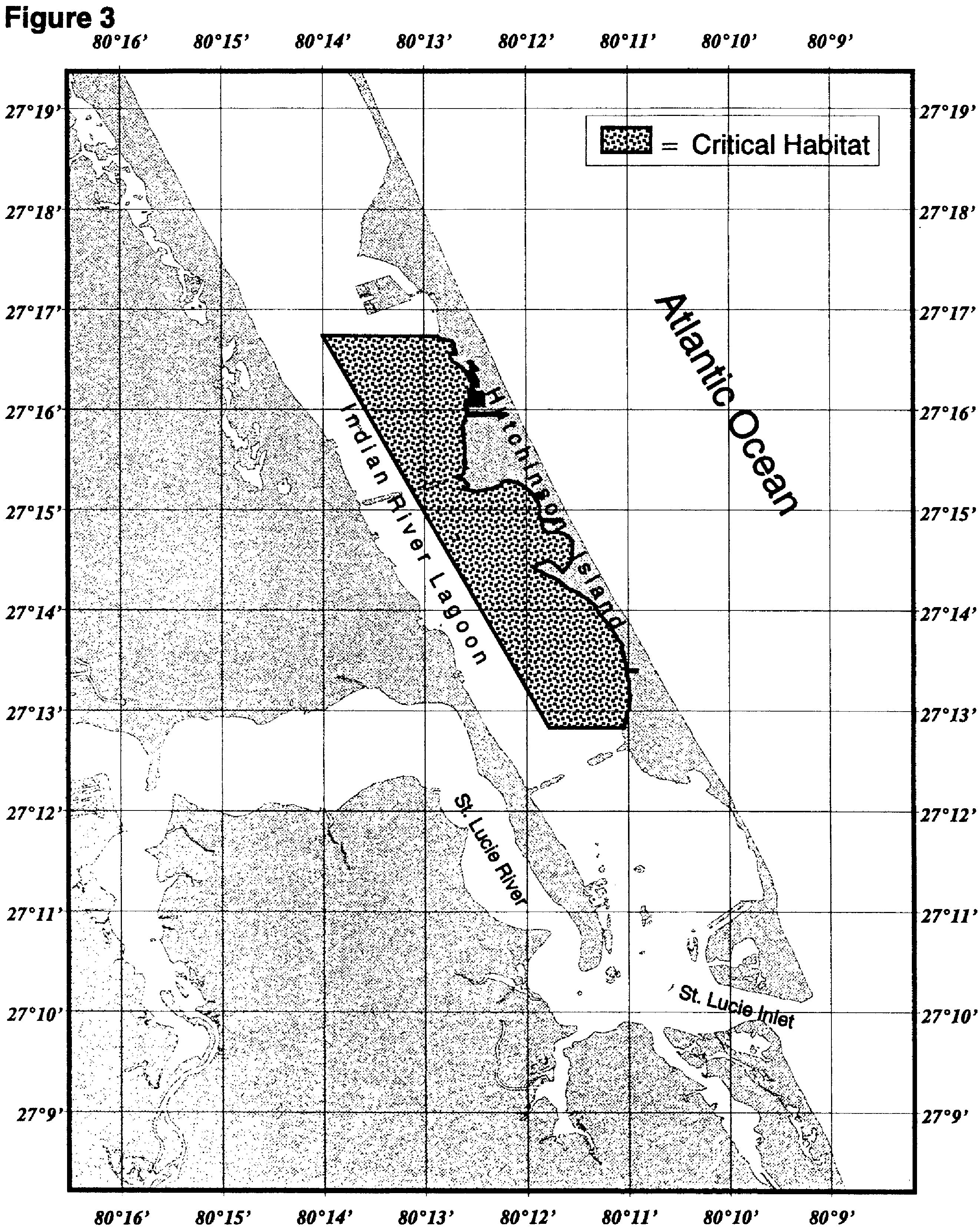
(d) A portion of the Indian River Lagoon, Florida, north of the St. Lucie Inlet, from South Nettles Island to the Florida Oceanographic Institute, defined by the following coordinates and excluding the Federally-marked navigation channel of the Intracoastal Waterway (ICW):
Northwest corner: 27°16′44.04″N, 80°14′00.00″W
Northeast corner: 27°16′44.04″N, 80°12′51.33″W
Southwest corner: 27°12′49.70″N, 80°11′46.80″W
Southeast corner: 27°12′49.70″N, 80°11′02.50″W
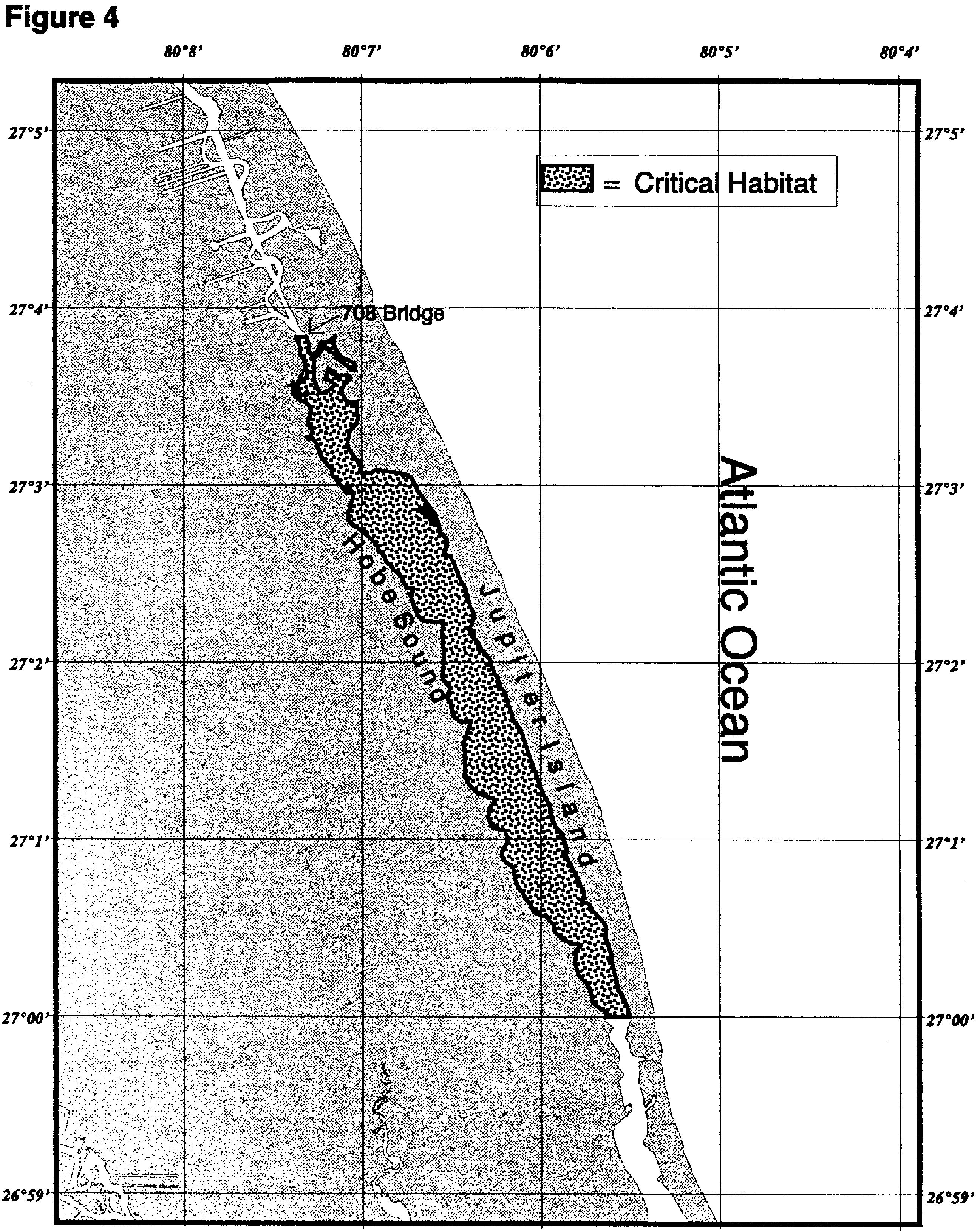
(e) Hobe Sound beginning at State Road 708 (27°03′49.90″N, 80°07′20.57″W) and extending south to 27°00′00.00″N, 80°05′32.54″W and excluding the federally-marked navigation channel of the ICW.
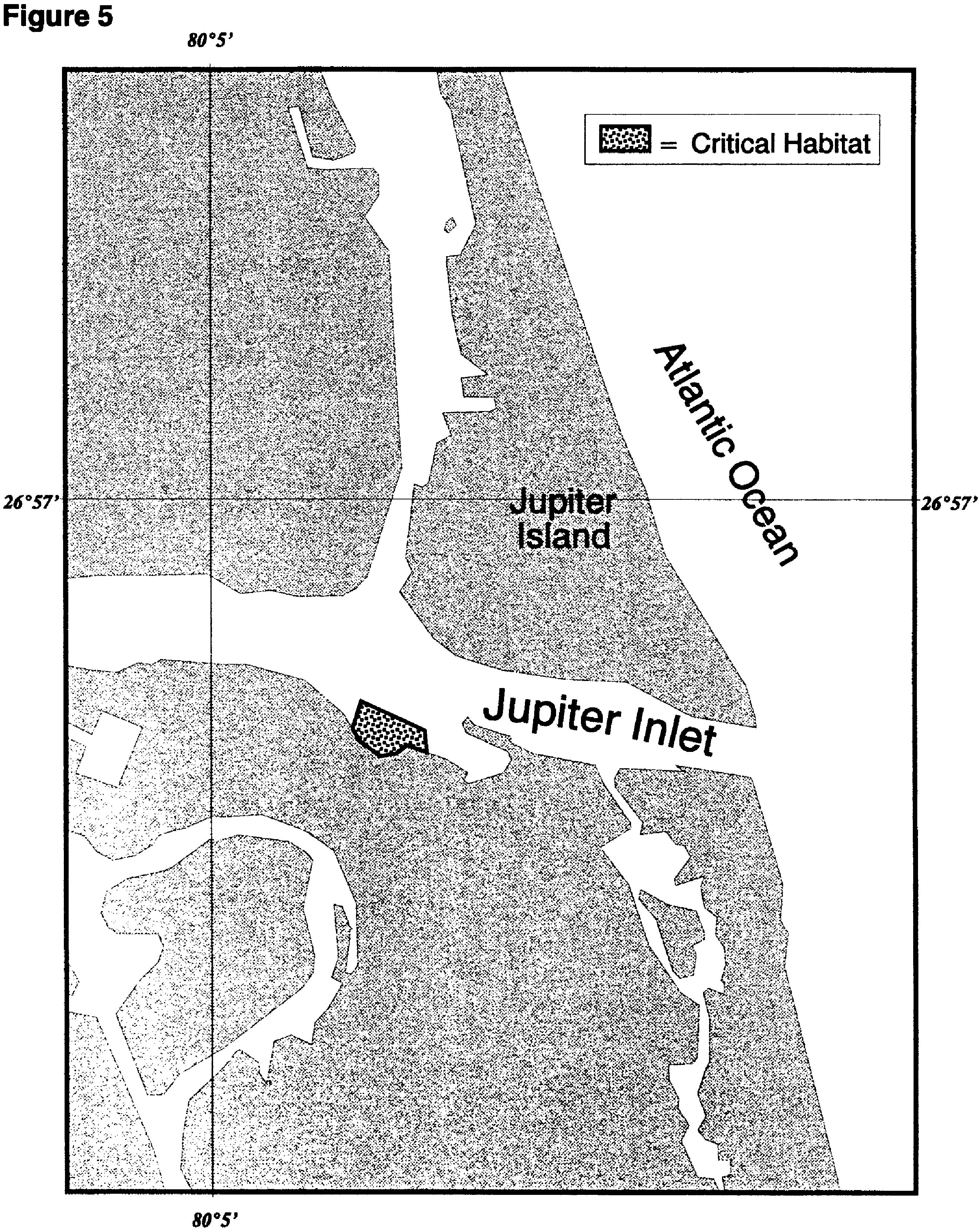
(f) Jupiter Inlet at a site located just west of the entrance to Zeek's Marina on the south side of Jupiter Inlet and defined by the following coordinates (note a south central point was included to better define the shape of the southern boundary):
Northwest corner: 26°56′43.34″N, 80°04′47.84″W
Northeast corner: 26°56′40.93″N, 80°04′42.61″W
Southwest corner: 26°56′40.73″N, 80°04′48.65″W
South central point: 26°56′38.11″N, 80°04′45.83″W
Southeast corner: 26°56′38.31″N, 80°04′42.41″W
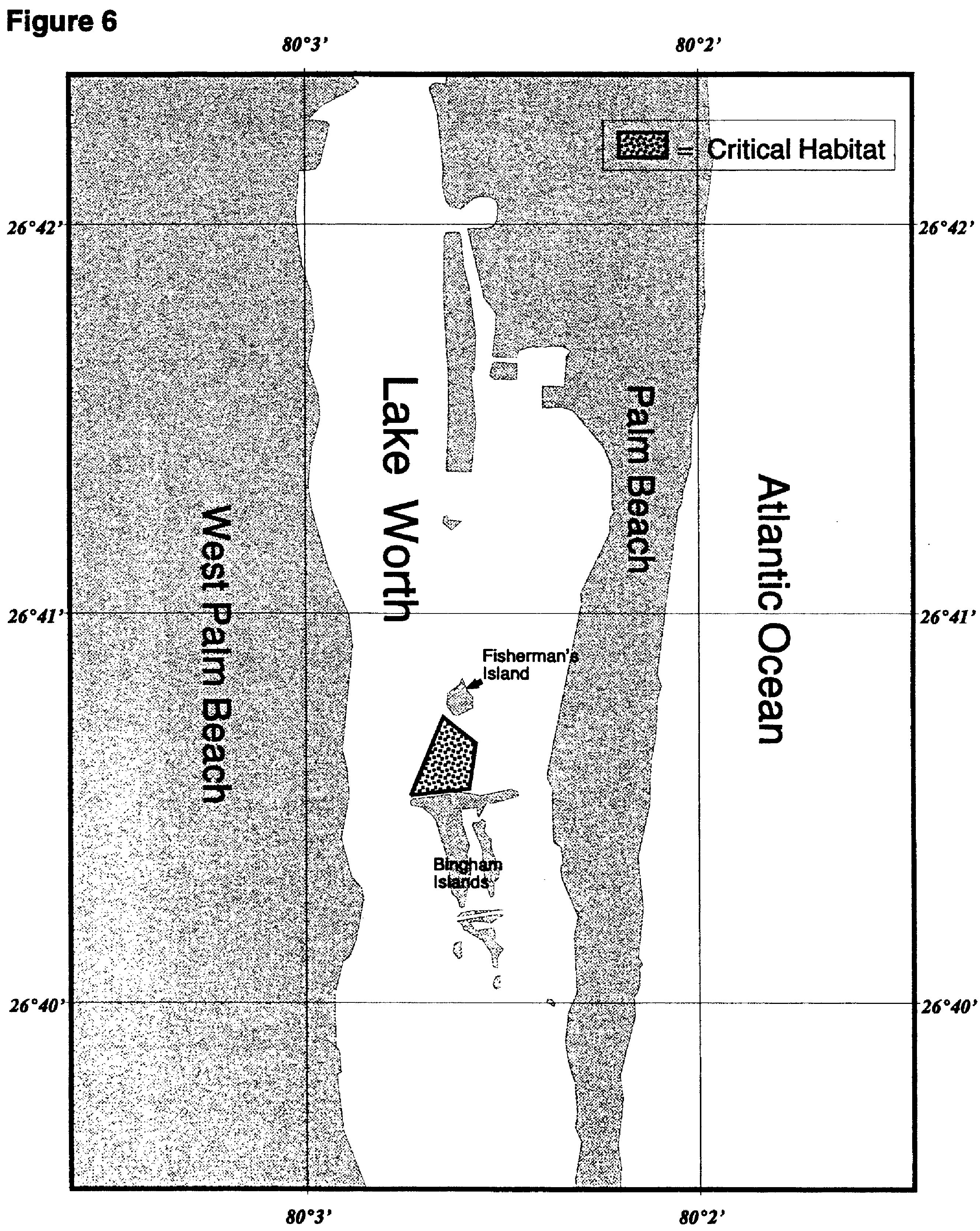
(g) A portion of Lake Worth, Florida, just north of Bingham Island defined by the following coordinates and excluding the Federally-marked navigation channel of the ICW:
Northwest corner: 26°40′44.00″N, 80°02′39.00″W
Northeast corner: 26°40′40.00″N, 80°02′34.00″W
Southwest corner: 26°40′32.00″N, 80°02′44.00″W
Southeast corner: 26°40′33.00″N, 80°02′35.00″W
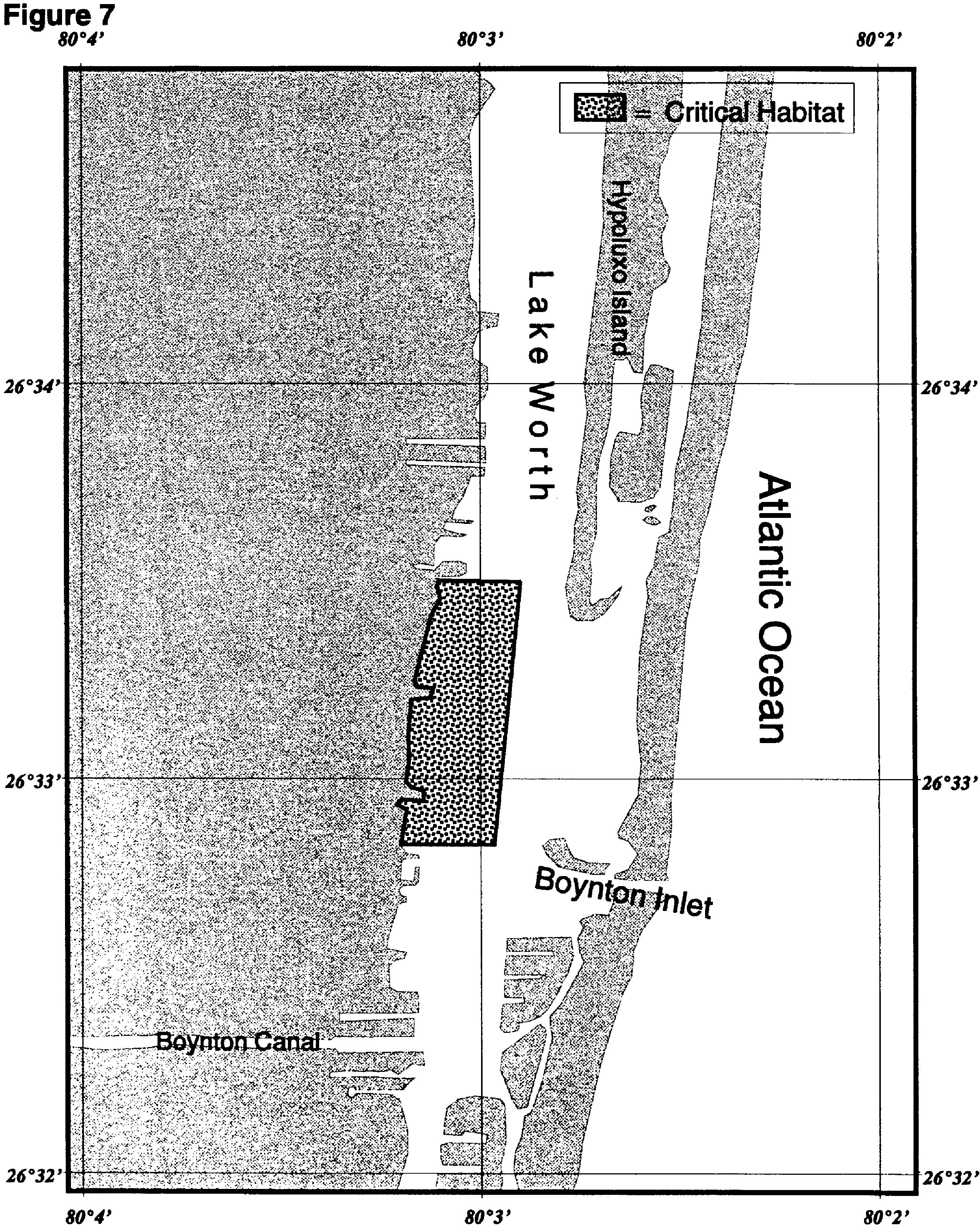
(h) A portion of Lake Worth Lagoon, Florida, located just north of the Boynton Inlet, on the west side of the ICW, defined by the following coordinates and excluding the Federally-marked navigation channel of the ICW:
Northwest corner: 26°33′28.00″N, 80°02′54.00″W
Northeast corner: 26°33′30.00″N, 80°03′04.00″W
Southwest corner: 26°32′50.00″N, 80°03′11.00″W
Southeast corner: 26°32′50.00″N, 80°02′58.00″W
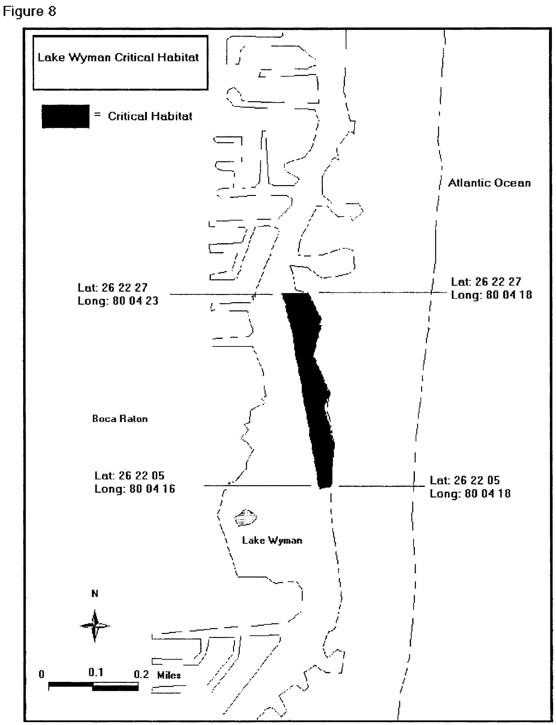
(i) A portion of northeast Lake Wyman, Boca Raton, Florida, defined by the following coordinates and excluding the Federally-marked navigation channel of the ICW:
Northwest corner: 26°22′27.00″N, 80°04′23.00″W
Northeast corner: 26°22′27.00″N, 80°04′18.00″W
Southwest corner: 26°22′05.00″N, 80°04′16.00″W
Southeast corner: 26°22′05.00″N, 80°04′18.00″W
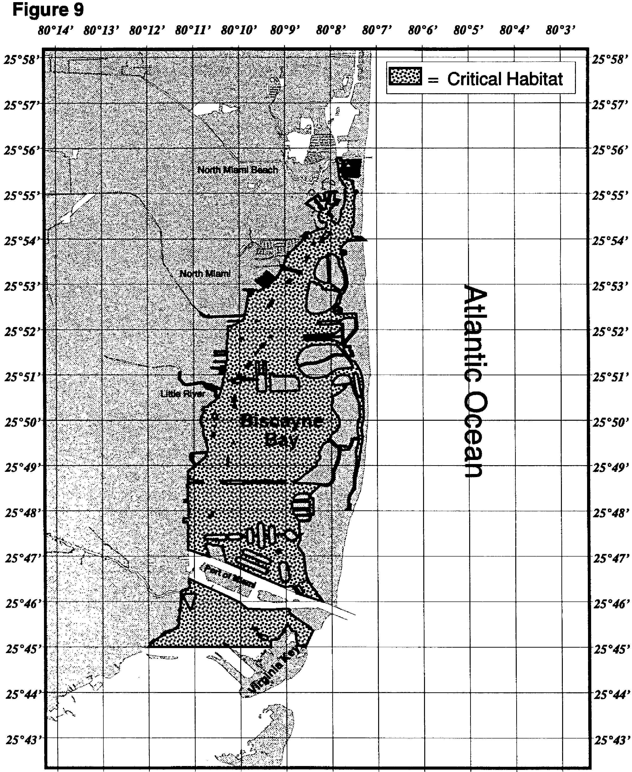
(j) A portion of Northern Biscayne Bay, Florida, defined by the following: The northern boundary of Biscayne Bay Aquatic Preserve, NE 163rd Street, and including all parts of the Biscayne Bay Aquatics Preserve as defined in 18–18.002 of the Florida Administrative Code (F.A.C.) excluding the Oleta River, Miami River and Little River beyond their mouths, the federally-marked navigation channel of the ICW, and all existing federally authorized navigation channels, basins, and berths at the Port of Miami to the currently documented southernmost range of Johnson's seagrass, Central Key Biscayne (25°45′N).
Cite this article: FindLaw.com - Code of Federal Regulations Title 50. Wildlife and Fisheries § 50.226.213 Critical habitat for Johnson's seagrass - last updated January 02, 2025 | https://codes.findlaw.com/cfr/title-50-wildlife-and-fisheries/cfr-sect-50-226-213/
FindLaw Codes may not reflect the most recent version of the law in your jurisdiction. Please verify the status of the code you are researching with the state legislature before relying on it for your legal needs.
Get help with your legal needs
FindLaw’s Learn About the Law features thousands of informational articles to help you understand your options. And if you’re ready to hire an attorney, find one in your area who can help.
