Learn About The Law
Get help with your legal needs
FindLaw’s Learn About the Law features thousands of informational articles to help you understand your options. And if you’re ready to hire an attorney, find one in your area who can help.
Current as of January 02, 2025 | Updated by Findlaw Staff
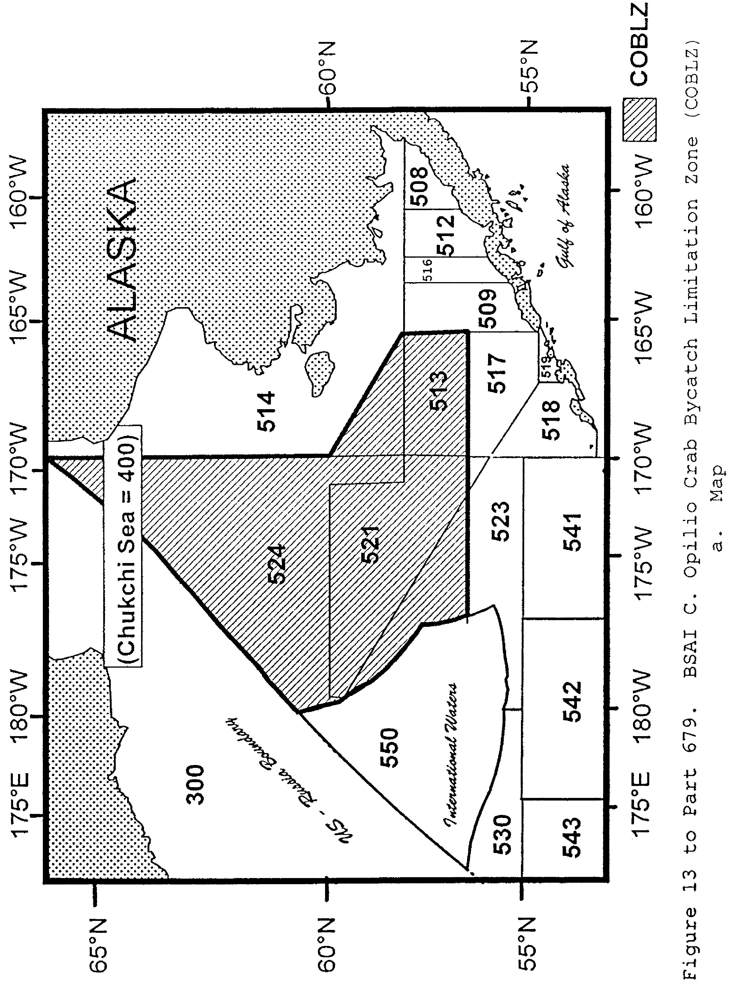
a. Map
b. Coordinates
The COBLZ is an area defined as that portion of the Bering Sea Subarea north of 56°30′ N. lat. that is west of a line connecting the following coordinates in the order listed:
56°30′ N. lat., 165°00′ W. long.
58°00′ N. lat., 165°00′ W. long.
59°30′ N. lat., 170°00′ W. long.
and north along 170°00′ W. long. to its intersection with the U.S.–Russia Boundary.
Cite this article: FindLaw.com - Code of Federal Regulations Title 50. Wildlife and Fisheries 50 CFR Pt. 679, Fig. 13 FIGURE 13 TO PART 679—BSAI C. OPILIO TANNER CRAB BYCATCH LIMITATIONS ZONE - last updated January 02, 2025 | https://codes.findlaw.com/cfr/title-50-wildlife-and-fisheries/cfr-pt-50-679-fig-13/
FindLaw Codes may not reflect the most recent version of the law in your jurisdiction. Please verify the status of the code you are researching with the state legislature before relying on it for your legal needs.
Get help with your legal needs
FindLaw’s Learn About the Law features thousands of informational articles to help you understand your options. And if you’re ready to hire an attorney, find one in your area who can help.
